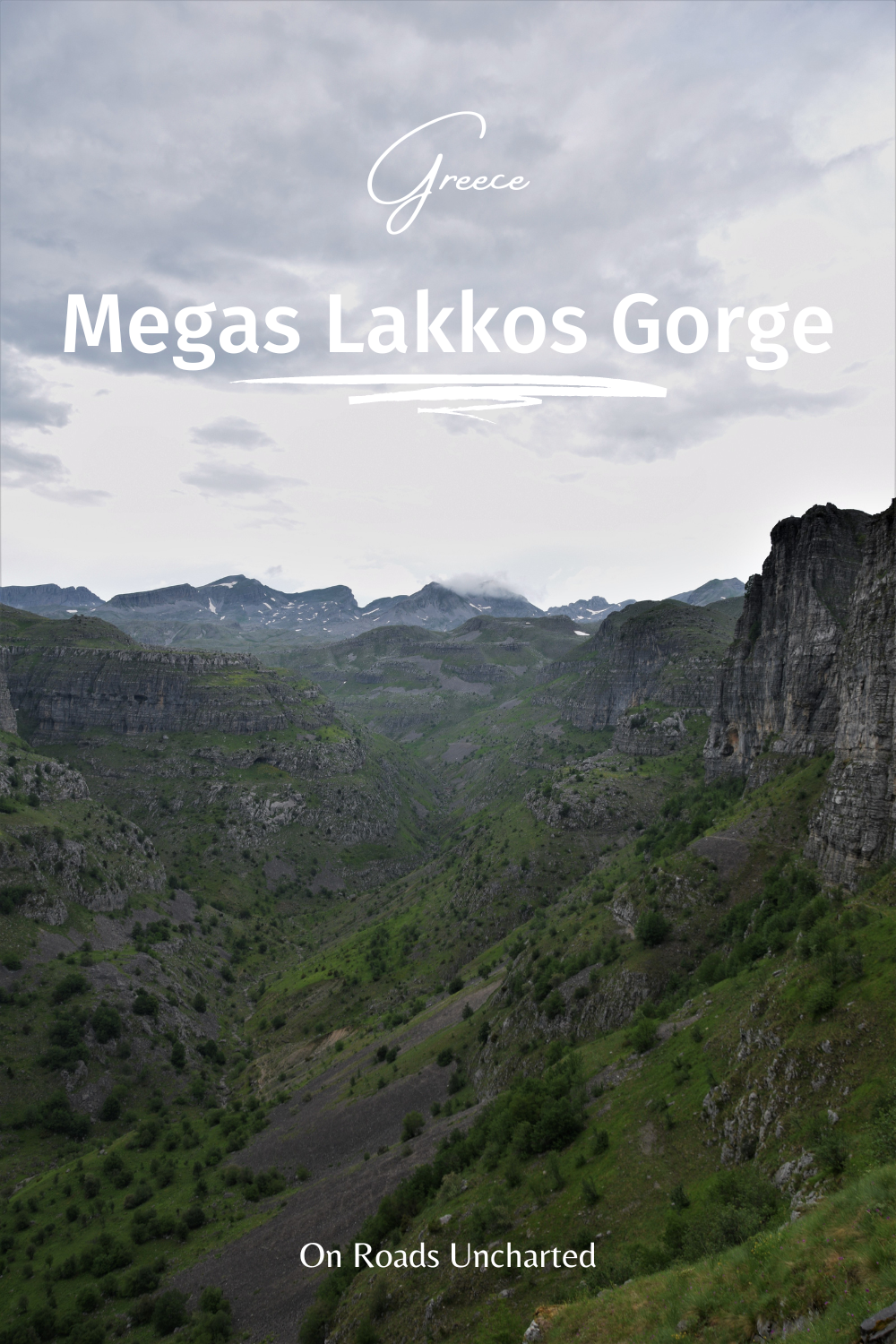
Overshadowed by the record-breaking Vikos Gorge, Megas Lakkos sees only a fraction of the visitors. Those who leave the established viewpoints behind, however, will find a land of unbridled beauty, easily rivalling (and sometimes even surpassing) the grandeur of Vikos.
While Vikos Gorge (the world’s deepest canyon relatively to its width) basks in the limelight, Megas Lakkos lies forgotten. Branching off from its famous sibling right under the oblivious eyes of many a tourist, the lack of attention seems odd. And yet, aeons of petrified history flashed by in an instant, as I journeyed from the boulder-strewn expanses of Tymfi to its towering exit, without encountering a single soul.
Wandering along its ancient slopes, I caught myself cheating. I realised that I relished Megas Lakkos as much as Vikos, my first Epirote love.
It felt less…polished, its allure hailing from its unadorned rawness, rather than its perfect appearance.
I am not implying you should skip Vikos. By no means. It deserves all the praise. However, when jagged peaks rise above a gorge’s depth, it hits different.
Megas Lakkos might live in the shadow of Vikos, but maybe that’s a good thing.
This guide contains all the necessary information you need before heading to Megas Lakkos Gorge, including how to reach the trailhead, a hike description, the best time to go, and tons of useful tips for a successful trip to this natural monument.
MEGAS LAKKOS GORGE
DISTANCE | 14km
ELEVATION | 660m +/-
DURATION | 5-6 hours
DIFFICULTY | Easy
BEST TIME | Fall (Oct-Nov)
A COW'S TRAIL
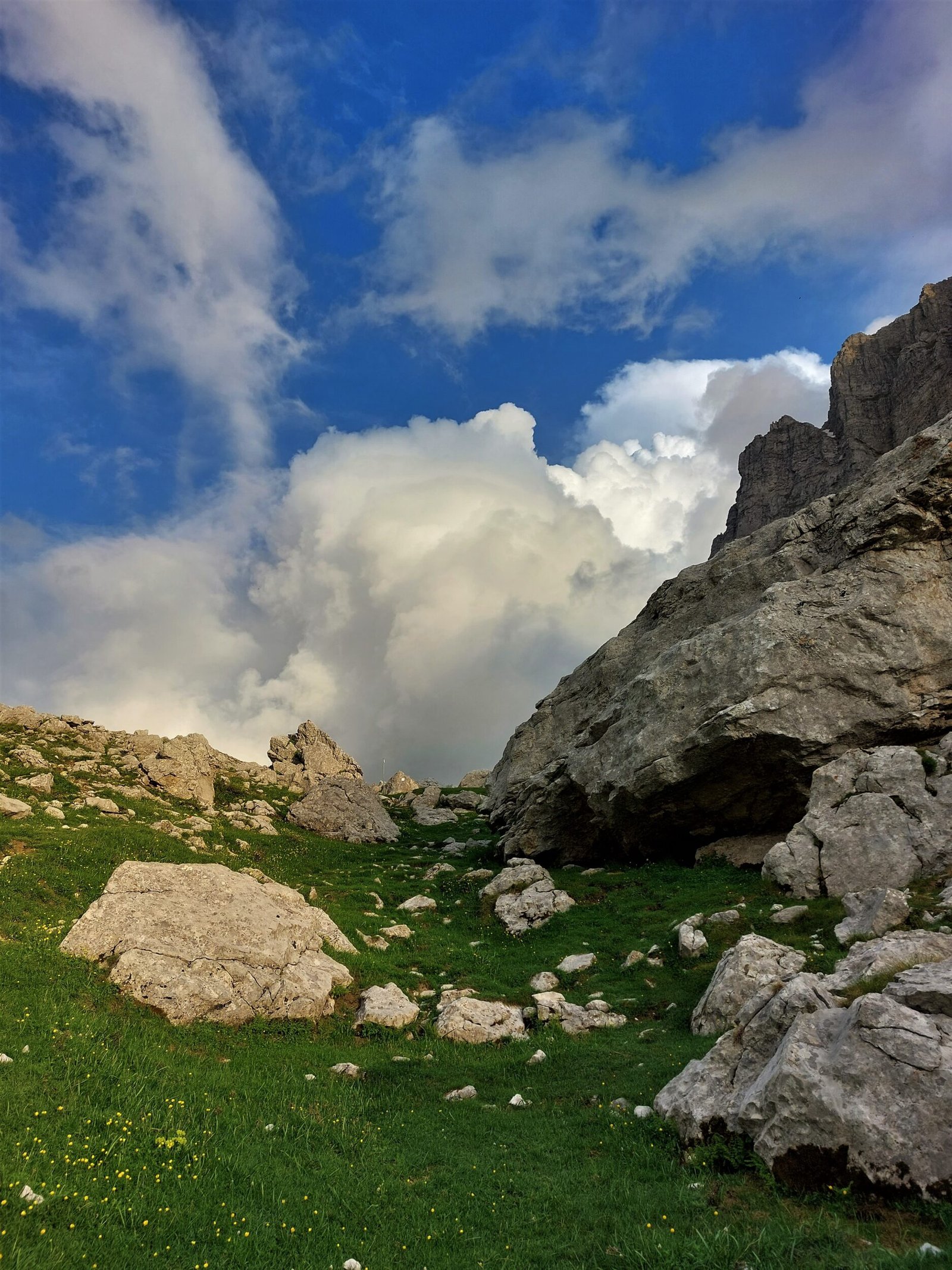
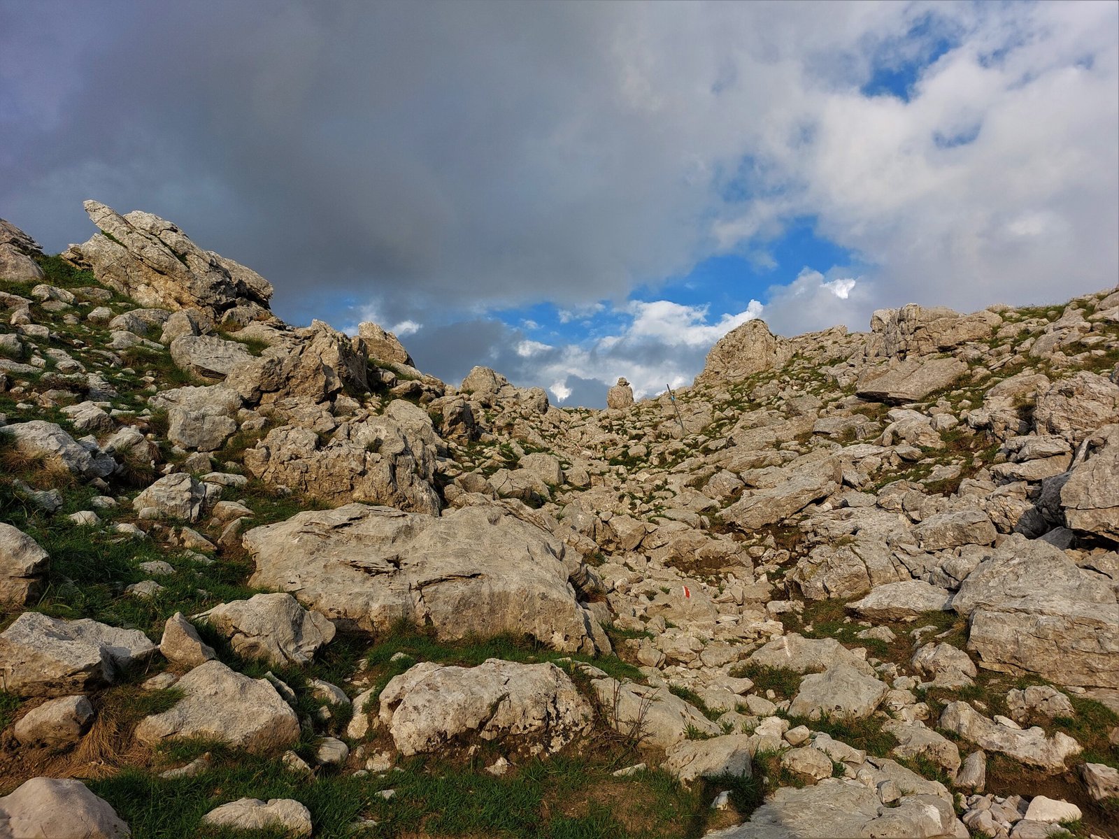
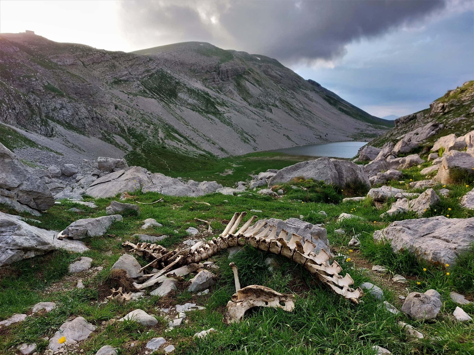
When the warm rays of the rising sun start revealing the scraggly peaks of Tymfi, it is time to shoulder your backpack and commence your journey towards Megas Lakkos. From the refuge, the rocky path snakes down to the southern shores of Xeroloutsa lake before leading hikers up a hillside littered with granite boulders cast away by the mountains.
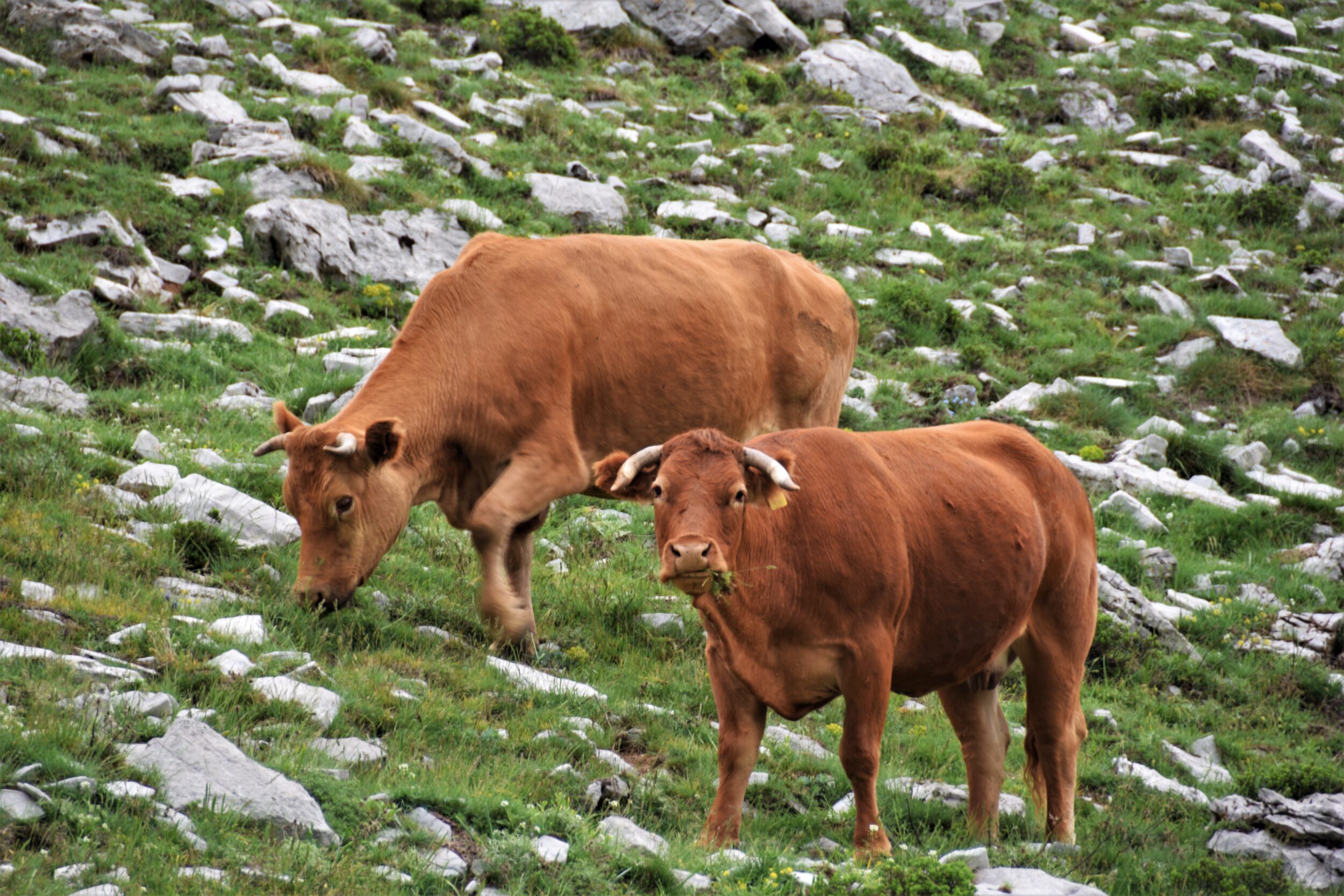
Beyond the rocks, the high-rising scarps of Astraka loom ominously as the trail continues across a verdant meadow, wetted by the morning dew and speckled with hundreds of yellow wildflowers. It is on these lush pastures Epirote cows spend the summer months, roaming freely across the undulating hills and peacefully grazing on the lush grass that previously slumbered underneath a thick blanket of ice and snow.
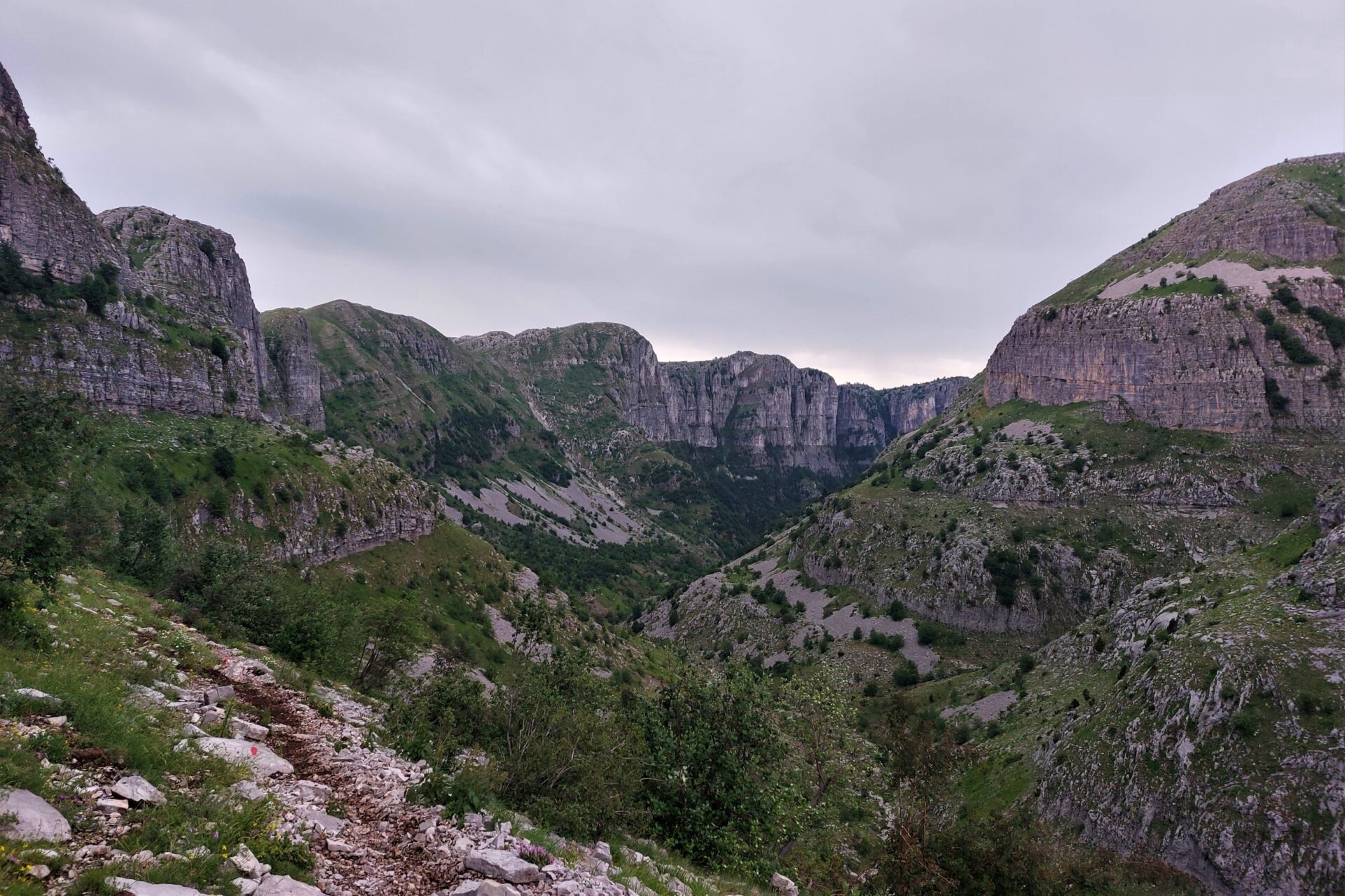
Once you pass the still surface of Loutsa Robozi lake, the terrain suddenly falls off and unveils the gentle beginnings of the gorge. As you follow the dirt path, lined by cows curiously observing your every move, the landscape becomes ever more rugged again before the imposing walls of Megas Lakkos completely dominate the scenery.
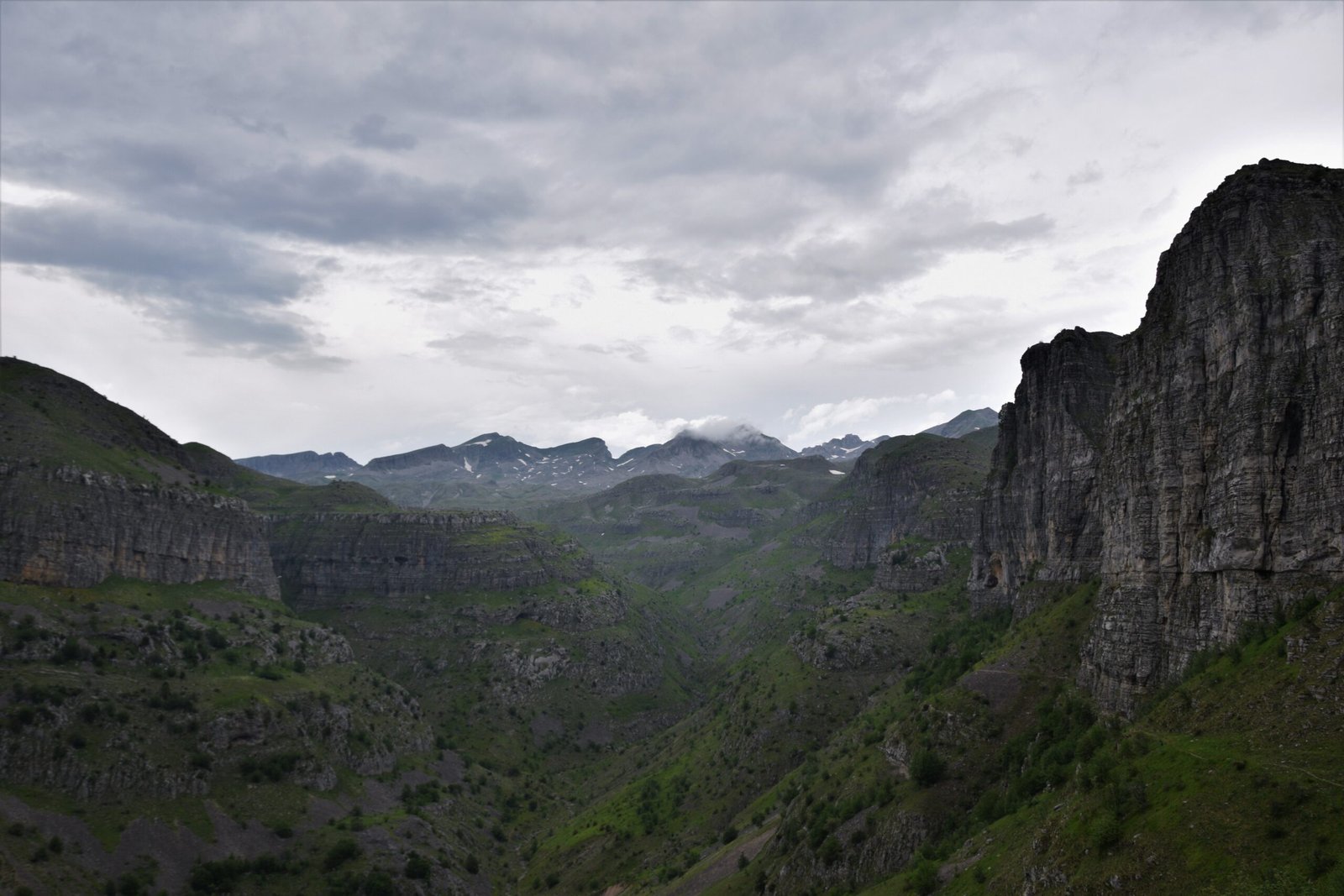
THE CANYON'S EMBRACE
After descending to the very bottom of the canyon and crossing the dried-up river bed, the trail climbs up the left side of Megas Lakkos. Running along the rocky slope, the gorge bends and opens up, finally manifesting its entire greatness to the world. Glimpses of Vikos beyond a lithic gate in front, the summits of Tymfi rising to lofty heights behind, wonderfully connected by Megas Lakkos cutting through the Pindos mountains.
Unfortunately, Megas Lakkos can’t be walked in its entirety and soon the path diverges towards the lonely highlands above the gorge. Small depressions alternate with green meadows until the trail reaches a small reservoir. Now, the path winds down the mountain side, presenting a stunning panorama of snow-covered peaks and forested foothills, before reaching the concrete road towards Vradeto, the last and unsurprisingly least exciting stretch of the trek.
REACHING THE TRAILHEAD FROM MIKRO PAPINGO
Before hiking Megas Lakkos Gorge, you will first have to reach the Astraka hut. Since the trail from Mikro Papingo up to the refuge is the most popular and well-established route, I’ll assume that you start the trek there.
Once in Mikro Papingo, simply follow the signs pointing you towards the trail. The path is well-marked and easy to follow. As it winds up the mountainside, you will come across a couple of mountain springs perfectly positioned to refresh yourself during the strenuous ascent.
The trail has a length of 5 ½ km and it will take around three hours to reach the refuge.
Should you start the trek in the morning, you will reach the hut around noon. If so, I highly recommend using the afternoon to hike up to Drakolimni, the “Dragon Lake”, as its dramatic location serves as a wonderful introduction to the stunning scenery that awaits you the next day.
WANNA FIND OUT MORE ABOUT THE DRAGON LAKE?
HOW TO GET TO MIKRO PAPINGO WITHOUT A CAR
I am not gonna lie, getting to Mikro Papingo without a car is a pain in the ass. Public transport to the village is scarce (massive understatement). The sole bus going there from Ioannina runs once every two weeks!
The only way to get there otherwise is a combination of public buses and hitchhiking. I know, not everyone’s favourite but the only option if you still want to embark on this hike without handing over your precious travel money to a cunning taxi driver taking advantage of the atrocious public transport situation or waiting around for one of those elusive buses.
Here is what you have to do:
1 | Take a bus either towards Kakavie (Albanian border) or Konitsa and get off in Kalpaki. Since you will have to hitchhike from there, the earlier you leave Ioannina the better. Check the schedule here.
2 | Once you get dropped off, head to the northbound road leading towards Konitsa. Find yourself a spot where people can easily stop and pick you up and start putting your thumb to use.
Should you be unsuccessful in your quest to get to Mikro Papingo directly, try to make it to Aristi at least. Either continue hitchhiking from there or arrange yourself a taxi (still not ideal but way cheaper than from Kalpaki).
Obviously, the same applies when you want to leave Mikro Papingo. Unless you time it perfectly with the bus schedule, there is no way around hitchhiking at least to the main road towards Ioannina (if you want to avoid a taxi).
THE ASTRAKA HUT
The Astraka hut is the sole refuge atop the Tymfi massif, and the ideal base for exploring this mesmerising area. They offer relatively affordable accommodation (18€/night; 13€/night for climbing club members), as well as hearty meals for hikers seeking to explore these magnificent mountains. The hut is operational between May-October/November, depending on the weather/snow conditions.
Be aware that you will have to reserve a bed beforehand via email.
You must also bring your own sleeping bag as they will only provide beds but neither blankets nor pillows.
For exact opening dates, further info, and contact check out their website.
HOW TO GET BACK TO IOANNINA
Once you reach Vradeto you will have a couple of options on how to return to Ioannina:
| By public bus. Since buses to the national park only run once every two weeks, you will have to plan your hike in accordance with the bus schedule if you want to use public transport to get back to Ioannina.
However, be aware that the buses are going to Kapesovo not Vradeto, adding another 3,5km to the hike. Unless you are starting super early from the refuge (preferably at sunrise or even before that), you won’t be able to reach Kapesovo in time as buses return to Ioannina quite early in the afternoon.
Definitely not the most viable option.
| By taxi. The easiest but also most expensive option. The price from Vradeto back to Ioannina is 60€ (June 2022).
| Hitchhiking. While you could test your luck trying to hitchhike back to Ioannina from Vradeto, you’ll massively increase your chances by tackling the Vradeto steps and reaching Kapesovo.
The only thing favouring Vradeto is the fact that the village is the starting point to reach the Beloi viewpoint (best views of Vikos Gorge). In theory there should be plenty of cars coming to/going from Vradeto during the day, however, I arrived late in the evening and found the village pretty much deserted so I can’t really attest to that.

IMPORTANT THINGS TO KNOW BEFORE YOU GO
1 | You will most likely need two days for the trek. Before you descend into Megas Lakkos Gorge from Tymfi, you will first have to reach the Astraka hut. Theoretically, the hike could be done in a single day, however, that relies entirely on an early arrival in Mikro Papingo.
While you could do it in a day (should you be short on time), I highly recommend spending a minimum of two days in the mountains to make the most of your time in Tymfi and properly explore this rugged land. An efficient and wonderful itinerary would be to hike up to Drakolimni (the “Dragon Lake”) from Mikro Papingo, then spend the night in the refuge on the initial day, before venturing into Megas Lakkos Gorge the next morning.
2 | Check the forecast. Good weather will be essential for a beautiful (and safe) day hiking Megas Lakkos Gorge. While the promise of rain shouldn’t necessarily deter you from your endeavours, tread carefully! The path might get slippery (especially the rocks), and you will be exposed to the elements at all times.
Also, weather in the mountains is prone to shift quite quickly, therefore always bring warmer clothes to be prepared.
3 | Mobile reception will be limited. Zagorochoria is extremely remote and the Tymfi massif even more so. It is very likely that you won’t have any reception at all during your hike. Keep in mind that this doesn’t affect GPS, so your offline maps (e.g., maps.me) will work just fine.
4 | Carry enough water for the day. I recommend bringing 2-3 litres for this hike. There is also a fountain roughly halfway through the trail if you need to refill your bottles.
5 | Bring snacks. Even though the guys at Astraka do offer quite a substantial range of meals for hungry hikers, you will have to bring the snacks for the trek yourself. I suggest buying your supplies already in Ioannina (or wherever you are stationed), before starting the hike.
Alternatively, you will find a small store in Makro Papingo but they are most likely limited in their selection.
6 | Wear robust footwear. Whether you are getting off the beaten path or following well-trodden trails, good hiking shoes are always essential when out and about in the mountains.
7 | Consider bringing hiking poles. While most of the trail descends in a very leisurely pace, you will encounter a few steeper sections, as well. To not put too much strain on your joints, hiking poles are a great offset.
8 | Pack sunscreen. We are talking about Greece here. Temperatures can easily climb up to 30°+ during the summer months, and even in autumn the sun is still potent. The Greek sun is no joke, so properly protect yourself from the heat!
9 | Bring bug spray. If you are hiking in spring pack mosquito repellent! While there is little to no midges up in Tymfi itself, the climb up through the forested areas is brutal. I forgot mine and my calves were swollen due to the exorbitant number of bites.

WHEN TO GO
Spring | When green pastures start peeking out from underneath their frozen blanket and wildflowers awake from their hibernal slumber, it is time to dust off your hiking shoes and head to the mountains again!
The hiking season in the Pindos mountains usually commences in May, however, it pretty much depends on the snow conditions and altitude whether hikes are already accessible early on in the year. However, temperatures might already reach around 30°C, despite the left-over snow.
Nevertheless, spring can be considered to be the most picturesque season of the year as blooming meadows, verdant slopes, and snowfields create a picture-perfect mountain landscape.
Summer | Although afternoon siestas and freddo espressos at the beach seem like the only sensible pastimes to endure the scorching summer heat, the Greek mountains enjoy their busiest period, as well.
As soon as the summer holiday season begins and the snow has finally melted away, all treks will be in prime condition for avid hikers to explore. While the weather will show its prettiest face, with sunshine and azure blue skies dominating the forecast, keep in mind that this is also the hottest time of the year, so pack enough water and sun protection.
Autumn | When the days grow shorter and the dim woods of Pindos change their dress, it is the perfect time for venturing out into this remote hinterland. Most tourist will have left Greece at that point, yet the trails, permeating this rugged land, will still present themselves in perfect hiking condition.
Temperatures will be ideal (10-20°C) and continuous rainfall shouldn’t be an issue either. It is also too early for snow to occur.
Lower temperatures, limited rainfall, and few people crown fall the best season for discovering the wonderful expanses of Tymfi.
WHERE TO NEXT?
For more content consider following me on Instagram.
Looking for more hiking inspiration? Here are some more treks to stir your wanderlust: