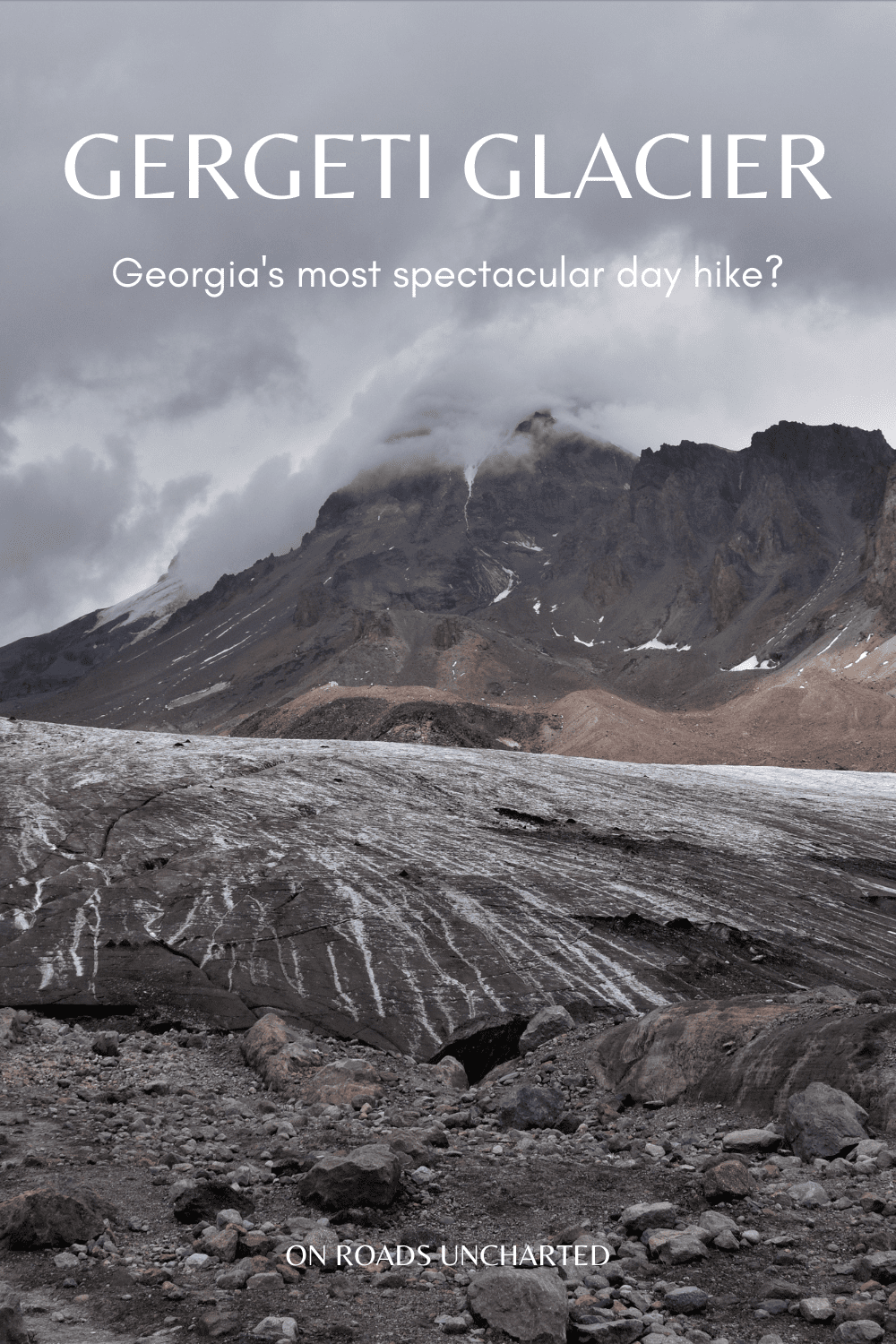
Located in the darksome shadows of Mount Kazbeg, the imposing Gergeti Glacier turned out to be one of the unforseen highlights of my time in Georgia. Sadly, overlooked by many a tourist (or luckily?), this challenging hike will lead you right into the most dramatic of mountain sceneries the Caucasus has to offer.
As we ascend, the daunting silhouette of Kazbegi rises ominously in front of us; dark and menacingly, a silent guide his face concealed behind an opaque mask. Soon, the last birches, clad in yellow dress, vanish, and reveal a wild land formed by the elements, exposed and naked yet unswerving and resilient.
Higher and higher we climb, across a harsh realm of jagged scarps and empty pastures, dusty trails leading us ever closer towards our ultimate destination.
And then, as we approach yet another crest, they are revealed. The perennial glacial fields of Gergeti.
Clinging to the rust-coloured scree slopes, aeon-old ice cascades down the rugged mountainside, a frozen stream tumbling towards the distant valley, grand and monumental, a mesmerising painting of untarnished beauty, only found in the outmost fringes of our vast and marvellous planet.
Few places feel so accessible yet so far removed.
Above us the clouds loom ever sinister, and frigid gales herald the foretold storm ahead. Nevertheless, we push onwards, the weather forecast reassuring us in our endeavour. Some time remains.
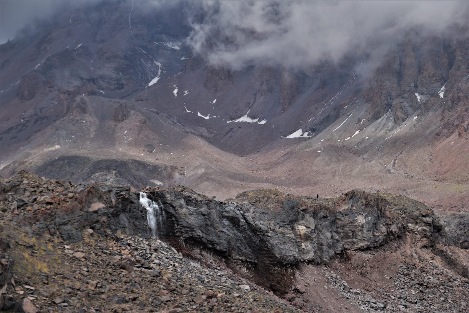
In lofty heights, the mountain grows evermore barren, the air thinner. As the last vegetation yields to the altitude, bare rock begins to dominate the terrain. Surrounded by desolation, we wander these inhospitable expanses in search for icebound reaches.
Then at last, the earth gets swallowed by ice and snow, laid to rest under a white, frosty blanket.
It is a spectacular and humbling sight.
This guide will provide you with all the necessary information to tackle the Gergeti Glacier hike independently, including how to get there from Tbilisi, what to bring, and more.

GERGETI GLACIER
DISTANCE | 15km *
ELEVATION | 1130m +/- *
DURATION | 7-8 hours
DIFFICULTY | Medium
BEST TIME | Summer (June-Sep)
*round trip from Gergeti Church
THE HIKE
While the trek might be a physical challenge due to the elevation gain (and subsequent altitude), finding your way up to the glacier is straight forward.
From Gergeti Trinity Church look towards Mount Kazbeg and you’ll spot a dirt path snaking up the hill left of the road. This is the starting point of the trail. Once you’ve tackled the first steep slope, the path will run along the ridge leading up to the mountain hut. Soon after, it will split in two. Although the trails will eventually converge again, I recommend choosing the right one as it offers simply stunning views of Mount Kazbeg and the surrounding mountain panorama throughout the ascent.
Once you reach the AltiHut refuge (after roughly 6km), it is another 1 ½ kilometre to the edge of the glacier.
How to get to Gergeti Trinity Church
Depending on your stamina and/or willingness to extend the hike, you are presented with two options:
- walk to Gergeti Trinity Chruch from Stepantsminda/Kazbegi
- take a taxi
Walking will add another three kilometres and 450 metres of elevation to the trek, while opting for a cab will come with a relatively hefty price (especially if you are travelling solo). Be aware that as of September 2022, the paved road is not accessible (most likely due to construction) and taxis will have to take the old dirt road, affecting the cost and time needed to reach the church.
The standard fare was 60 GEL (about 20€), as a point of reference should the road still be closed off when you visit. The ride on the dirt trek takes roughly 15-20min.


HOW TO GET TO KAZBEGI FROM TBILISI
Whether you are looking for the cheapest option (marshrutka/minibus) or a more comfortable ride in a shared taxi, you will have to get yourself to Tbilisi since all transportation to Kazbegi/Stepantsminda departs from the Georgian capital (Didube bus station).
How to get to Didube Bus Station
Take metro line 1 (red line) to Didube station. Once you get off the train, head to the exit to your right and down the stairs. Now, turn right and follow the underpass until you reach the bus terminal.
The metro ride will cost 1 GEL.
Getting to Kazbegi/Stepantsminda by marshrutka | Once you leave the tunnel, you’ll find yourself on a parking lot full of marshrutkas and pesky taxi drivers trying to convince you that a cab ride to Kazbegi is the only option. Ignore them and continue walking straight for about 100 metres. Before you leave the bus station and enter the roundabout, turn right. Hidden behind a couple of fruit stands, you’ll find another courtyard.
The marshrutka to Kazbegi will be on your right-hand side, immediately after the stalls.
The ride to Kazbegi takes 3 ½-4 hours and costs 15 GEL (September 2022).
Getting to Kazbegi/Stepantsminda by shared taxi | Alternatively, you could opt for a shared taxi instead. Prices will hover around 40 GEL/person (September 2022), however, the ride will be faster and more comfortable than with a marshrutka.
An added bonus is that you might stop at certain sights along the Georgian Military Highway (e.g., Russian-Georgia Friendship Monument).
Keep in mind that, although you are taking a taxi, your driver will drop you off at the bus station in the centre of Kazbegi not your hotel.


WHAT TO BRING
Gear | Good footwear is essential for a pleasant day out in the mountains. Also, make sure to bring warm clothes, especially if you are hiking late in the season. The glacier sits 3300 metres above sea level and even in summer, temperatures might not reach 10°C. A warm outdoor jacket, gloves, and a cap are definitely not a bad choice!
Hiking poles are also highly recommended since the descent can be pretty steep at times.
Besides the items mentioned above, the hike doesn’t require any special equipment, unless you want to traverse the glacier. In that case, proper gear (at least crampons) are essential to ensure your safety. People have died in the past trying to cross the ice, lacking both preparation/experience and sufficient equipment.
Food | Bring enough snacks. The ascent to Gergeti Glacier, albeit relatively short, is steep and arduous and you’ll need the extra energy. In addition, the AltiHut provides warm meals for weary wanderers.
Water | I recommend carrying 1-2 litres, depending on the weather. You can either refill your bottle at the refuge or the stream coming down from the glacier, however, the water will be mirky and full of sediments (although still drinkable), so you might wanna bring something to purify the water.
Sun protection | Besides a small stretch of birch forest at the start of the trail, there is zero shade on the path, so make sure to bring sunscreen.
WHEN TO GO
Normally, the trek is accessible from the beginning of June to the end of September/early October. On the day of our departure (late September), the peaks around Kazbegi were already covered in snow.
Also, always make sure to check the forecast, as Kazbegi is prone to rapid weather changes even during the summer months. A clear sky in the morning might transform into a massive thunderstorm merely in the matter of hours (as happened to us).

WHERE TO NEXT?
For more content consider following me on Instagram.
Looking for more hiking inspiration? You might want to consider these places:
THE SLOVAK PARADISE NATIONAL PARK
5 BEAUTIFUL HIKES IN THE VIKOS-AOOS NATIONAL PARK
GAMILA | TYMFI’S HIGHEST SUMMIT