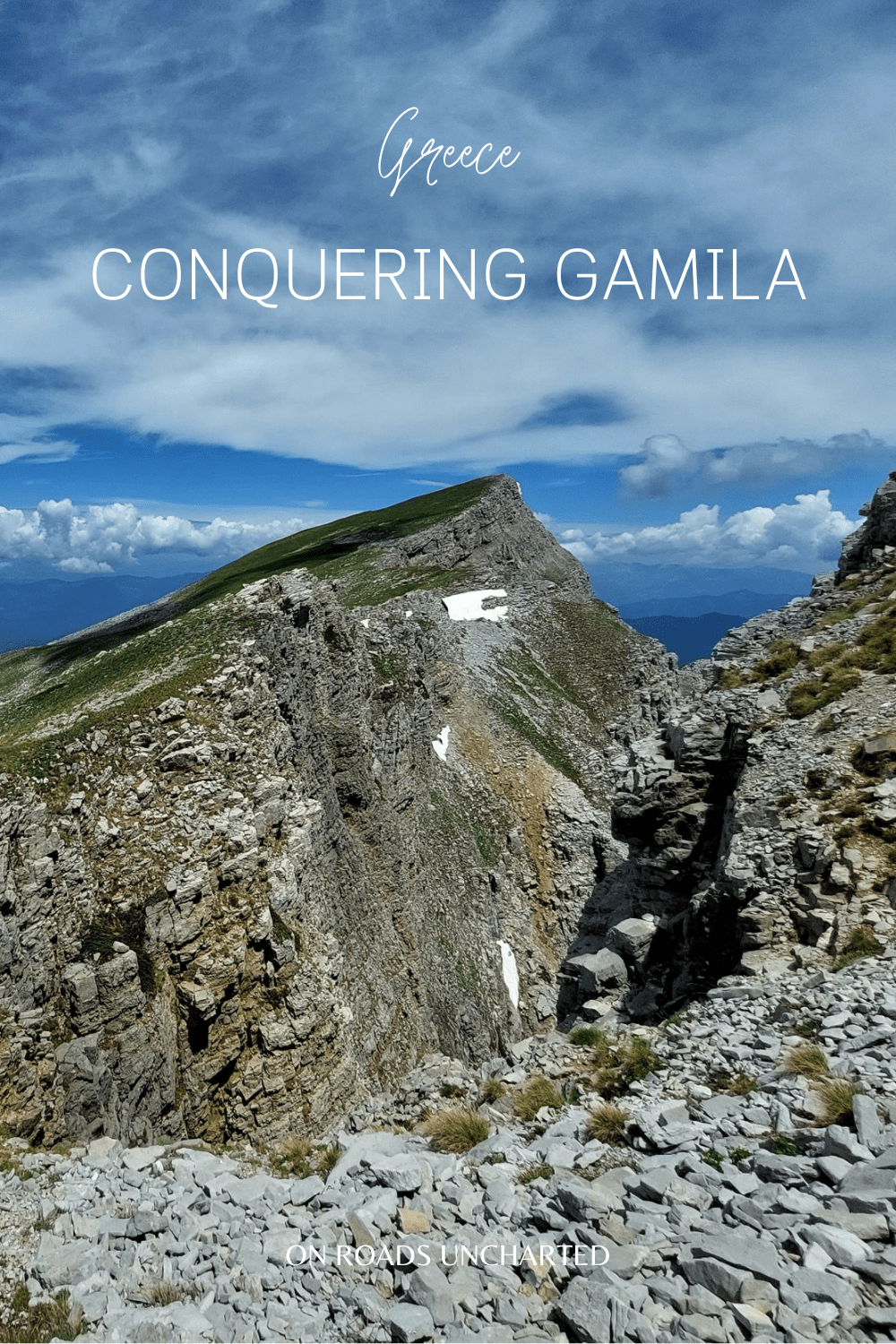
Ascending the sublime summit of Gamila is the pinnacle of hiking in the Tymfi massif. It is a superb journey across a rugged mountain realm of verdant meadows, stone forests, and sheer cliffsides, and my favourite trek in Greece. A true adventure in the country’s forgotten north.
Vikos-Aaos National Park, situated in Greece’s Epirus region, is anything but shy of epic hikes and memorable days spent amongst the imposing peaks of Pindos. I have written and raved about the autumnal splendour of Vikos Gorge and the magic of Drakolimni (the “Dragon Lake”) ever since I accidentally stumbled upon this criminally underrated destination on my first visit to Europe’s most southern country. It wasn’t, however, until I returned to this enchanted land of lush pastures and scraggly summits that I truly got to experience the outmost magnificence hidden away in the shadows of these everlasting giants.
Once the path ends and losing the trail becomes a joy rather than a nuisance, your sole companions will be the soft caress of the wind traveling across this rugged landscape and the grand melodies of “The Lord of the Rings” sounding in your mind and pushing you ever onwards on your journey towards Gamila.
To experience the best Tymfi has to offer, you will have to lace your hiking shoes, and step off the beaten path. Beyond the trail, the earth will rise to lofty heights, and at last Tymfi will unfold its untarnished beauty to the world.
Here is everything you need to know to conquer Gamila, Tymfi’s highest summit, by yourself.

GAMILA-RIDGE-LOOP
DISTANCE | 14km round trip
ELEVATION | 700m +/-
DURATION | 6-8 hours
DIFFICULTY | Hard
BEST TIME | Fall (Oct-Nov)
EN ROUTE TO GAMILA
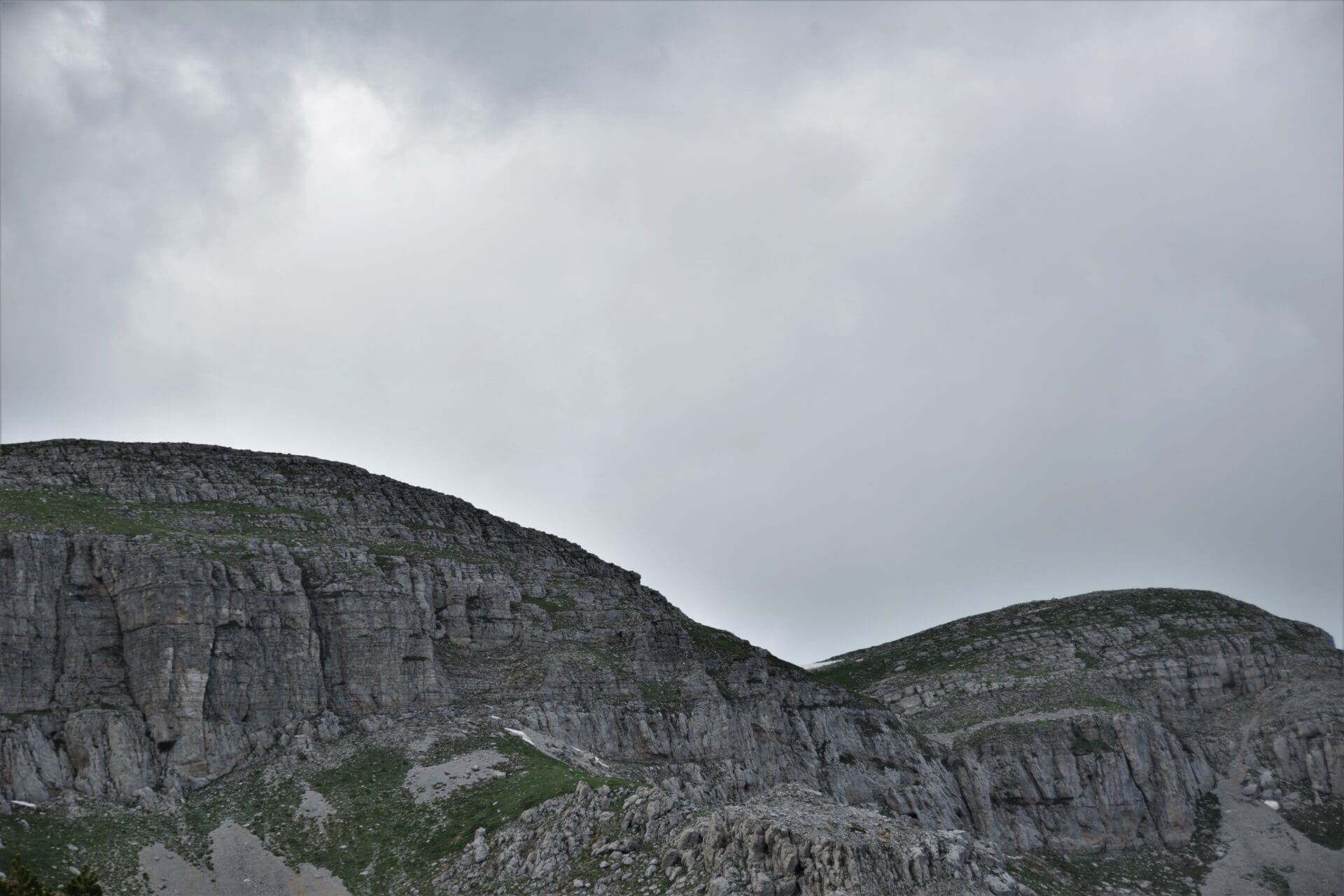
As soon as the first rays of light caress the perpendicular scarps of Tymfi, it is time to slip into your trusted hiking boots and welcome the stoic embrace of the mountains.
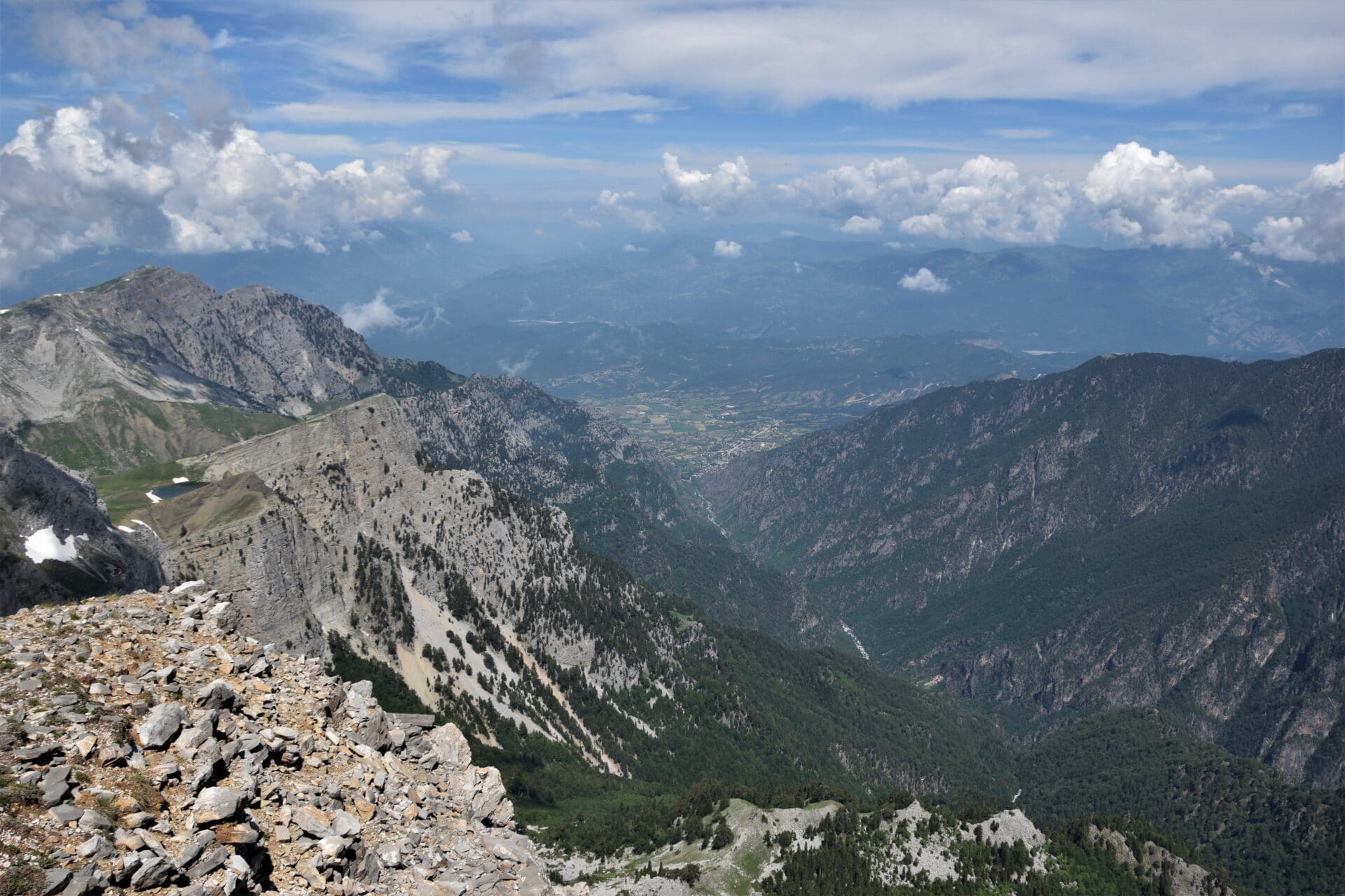
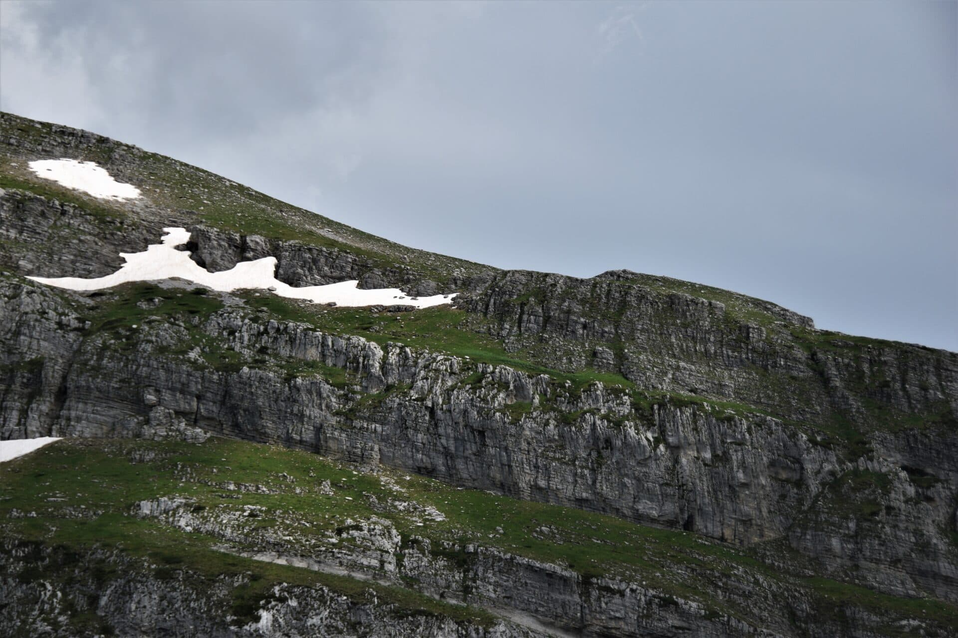
After a short descent to the southern end of lake Xeroloutsa, the path slowly creeps up a boulder-strewn slope, overshadowed by the imposing walls of Astraka, before reaching a beautiful, green pasture. For the first time Gamila will show its pointy contour on the horizon and herald the beginning of your imminent expedition through the vast expanses of this rugged land.
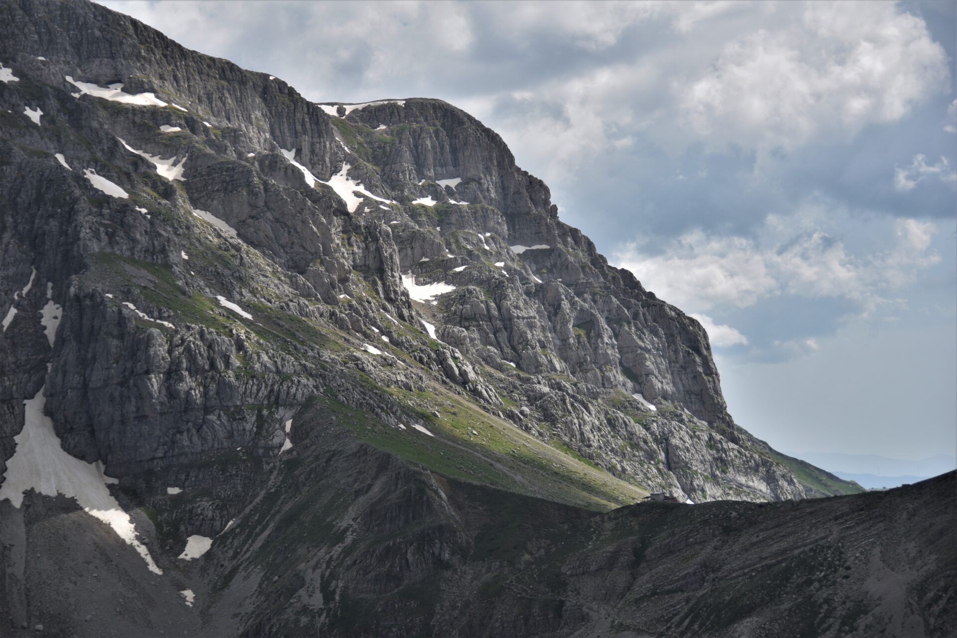
Follow the dried-up river bed, cutting through the rolling meadows, for roughly 200 metres before turning left and heading towards Gamila. The path will have vanished and occasional red markings and stone heaps will now guide you through this maze of boulders, verdant depressions, and scree slopes (as well as left-over snowfields) en route to your desired destination. After 2,5 kilometres you will reach the base of Gamila (a red arrow on the scree slope left to you will signal the trail to the summit). Now, merely a succinct but steep scramble stands between you and absolutely magnificent panoramic views.
ON THE EDGE
Once you soaked in all the mountain vistas Tymfi throws at you, you will have to choose whether to trace back the way you came from or whether to tackle the entire Gamila-Ridge-Loop (not an official name but let’s coin it!).
Be aware that you will enter truly unmarked territory, and that there won’t be a proper trail until you reach the pastures beneath Astraka again, should you decide to head towards Gamila II (Nkamela II on maps.me). Your journey will subsequently lead you along the edges of Tymfi, as you follow the ridge, jutting out into nothingness and presenting you with simply remarkable vistas of the Pindos mountains.
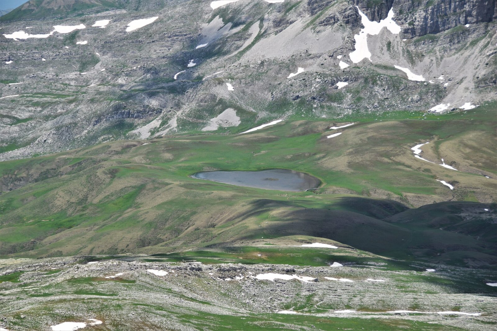
Once you have reached Gamila II, proceed to traverse the remote hinterlands of Tymfi again. If you are heading straight for Astraka, once more passing barren rock faces complemented by lush meadows adorned with blossoming carpets of colourful wildflowers, you will stumble upon the path back to the Astraka refuge eventually.
The entire trail is marked on maps.me.
However, I would advice to only embark on this endeavour if you feel confident getting off the trail and crossing remote and rugged mountain terrain (potentially on your own).
REACHING THE TRAILHEAD FROM MIKRO PAPINGO
To commence the Gamila-Ridge-Loop, you will first need to reach the Astraka hut. Since the trail from Mikro Papingo up to the refuge is the most popular and well-established route, I’ll assume that you start the trek there.
Once in Mikro Papingo, simply follow the signs pointing you towards the trail. The path is well-marked and easy to follow. As it winds up the mountainside, you will come across a series of gazebos and fountains perfectly positioned to rest your weary legs and refresh yourself during the strenuous ascent.
The trail has a length of 5 ½ km and it will take around three hours to reach the refuge.
Should you start the trek in the morning, you will reach the hut around noon. If that is the case, I highly recommend using the afternoon to hike up to Drakolimni, the “Dragon Lake”. It is a relatively easy hike and serves as a great introduction to the stunning scenery that will await you on the next day.
WANNA FIND OUT MORE ABOUT THE DRAGON LAKE?
HOW TO GET TO MIKRO PAPINGO WITHOUT A CAR
I am not gonna lie, getting to Mikro Papingo without a car is a pain in the ass. Public transport to the village is scarce (massive understatement). The sole bus going there from Ioannina runs once every two weeks!
The only way to get there otherwise is a combination of public buses and hitchhiking. I know, not everyone’s favourite but the only option if you still want to embark on this hike without handing over your precious travel money to a cunning taxi driver taking advantage of the atrocious public transport situation or waiting around for one of those elusive buses.
Here is what you have to do:
1 | Take a bus either towards Kakavie (Albanian border) or Konitsa and get off in Kalpaki. Since you will have to hitchhike from there, the earlier you leave Ioannina the better. Check the schedule here.
2 | Once you get dropped off, head to the northbound road leading towards Konitsa. Find yourself a spot where people can easily stop and pick you up and start putting your thumb to use.
Should you be unsuccessful in your quest to get to Mikro Papingo directly, try to make it to Aristi at least. Either continue hitchhiking from there or arrange yourself a taxi (still not ideal but way cheaper than from Kalpaki).
Obviously, the same applies when you want to leave Mikro Papingo. Unless you time it perfectly with the bus schedule, there is no way around hitchhiking at least to the main road towards Ioannina (if you want to avoid a taxi).


THE ASTRAKA HUT
The Astraka hut is the sole refuge atop the Tymfi massif, and the ideal base for tackling the Gamila-Ridge-Loop. They offer relatively affordable accommodation (18€/night; 13€/night for climbing club members), as well as hearty meals for hikers seeking to explore these magnificent mountains. The hut is operational between May-October/November, depending on the weather/snow conditions.
Be aware that you will have to reserve a bed beforehand via email.
You must also bring your own sleeping bag as they will only provide beds but neither blankets nor pillows.
For exact opening dates, further info, and contact check out their website.
IMPORTANT THINGS TO KNOW BEFORE YOU GO
1 | You will need at least two days for the whole trek. Before you commence your alpine adventure, you will first have to reach the Tymfi massif and the Astraka hut. If you have your own car or have arranged transport in Mikro Papingo, the entire trip can be done in two days. If you are relying on hitchhiking or the infrequent Epirote buses, I suggest spending a second night in the refuge before your descent.
2 | The hike requires a decent level of trekking experience. Although reaching Gamila is not the most challenging hike physically, it is definitely not a beginner’s hike either. While the first and last segments of the trail are well marked and easy to follow, the majority of the trek will be far away from well-trodden paths. Stone heaps, the occasional red markings, and simply the lay of the land will guide you on your journey towards the summit.
Since Gamila will always claim the horizon, it is virtually impossible to get lost. Nevertheless, I highly recommend using maps.me as a point of reference. The app functions offline, utilizing GPS, so you will always be able to find back on trek!
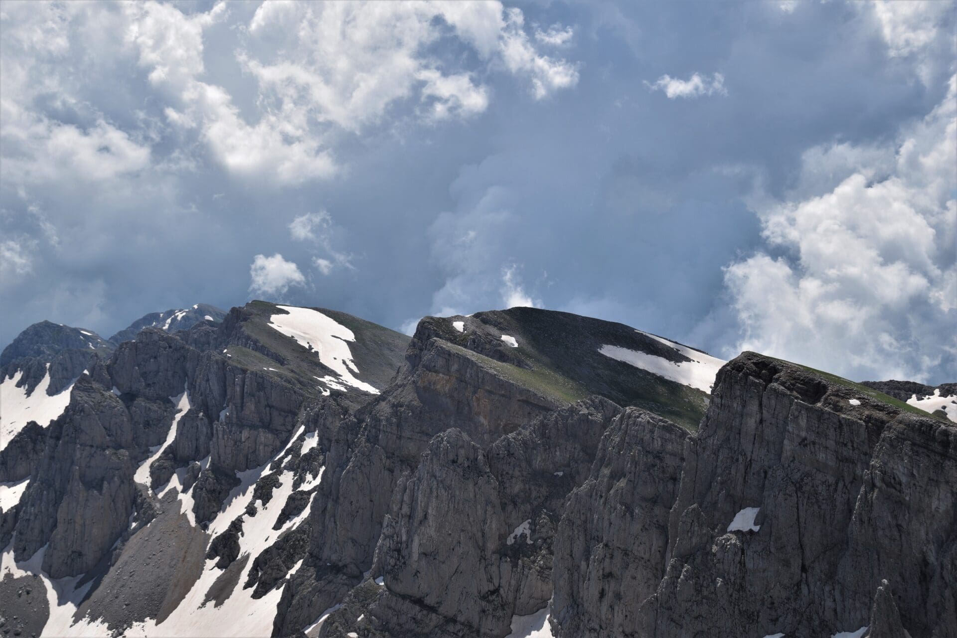
3 | Be prepared for snow if you are hiking in spring. If you plan on climbing Gamila early in the season, be prepared for snow. I went at the beginning of June and still encountered quite a few snowfields during the hike. While some could be traversed relatively easily, I suggest circumnavigating the steep ones for the most part (if possible), especially if you are descending.
Find out about the snow situation before you depart for the mountains to make sure the ascent is actually possible. Preferably, get in contact with the guys from the refuge as they will have the most accurate insight on the conditions.
4 | Check the forecast. Good weather will be essential for a beautiful (and safe) day wandering the expanses of Tymfi. While the promise of rain shouldn’t necessarily deter you from your endeavours, tread carefully! The rocks might get slippery, and you will be exposed to the elements at all times.
Also, weather in the mountains is prone to shift quite quickly, therefore always bring warmer clothes to be prepared.
5 | Mobile reception will be limited. Zagorochoria is extremely remote and the area around Gamila even more so. On the plateau between Gamila and Astraka you won’t have any reception at all. I only had signal on top of Gamila and along the ridge on route to Gamila II. Keep in mind that this doesn’t affect GPS, so your offline maps will work just fine.
For some odd reason, I was able to connect with Albanian networks, however.
6 | You will most likely be alone. Despite being the highest peak in Tymfi, Gamila is not a popular hike at all. In fact, you might not see a single soul for the entirety of the trek (especially if you do the complete ridge loop).
This might appeal to those of you (myself included) longing for the solitude of the mountains, however, paired with the limited reception it could prove quite dangerous in an emergency situation. Always let someone know your route (the guys at the Astraka refuge e.g.) before you embark on the hike. The last thing you want is being stuck in the mountains with no-one knowing where you are!

7 | Carry enough water for the day. As soon as you leave the heath stretching out below Astraka and head towards Gamila, there won’t be a single water source to refill your bottle. Therefore, I recommend bringing 2-3 litres in spring/autumn and at least 4 litres during the summer months.
Keep in mind that you can also use snow as a water source should you come across it! I wouldn’t advice to collect it in the lowlands, however, the snow in the mountains is perfectly fine to use. Merely get rid of the dirty layer on top and you found yourself an ideal way to refill your flask with ice cold mountain water! (I used the snow, and my stomach was fine in case you are wondering lol)
8 | Bring snacks. Even though the guys at Astraka do offer quite a substantial range of meals for hungry hikers, you will have to bring the snacks for the trek yourself. I suggest buying your supplies already in Ioannina (or wherever you are stationed), before starting the hike.
Alternatively, you will find a small store in Makro Papingo but they are most likely limited in their selection.
9 | Wear robust footwear. You will come across several different terrain types during the hike (meadows, scree slopes, potential snowfields, etc.), so good hiking shoes are essential. Ideally, you should also have experience walking on uneven ground and scrambling across rockier sections.
10 | Consider bringing hiking poles. The initial descents from Gamila and Gamila II respectively are quite steep, therefore poles will be a great way to support your joints and take stress off your knees.
11 | Pack sunscreen. Although you might encounter snow all the way to July, we are still talking about Greece here. Even in the mountains, temperatures can climb up to 30°+ during the summer months, so make sure to properly protect yourself from the heat. The Greek sun is no joke!
12 | Bring bug spray. If you are hiking in spring pack mosquito repellent! While there is little to no midges up in Tymfi itself, the climb up through the forested areas is brutal. I forgot mine and my calves were swollen due to the exorbitant number of bites.

WHEN TO GO
Spring | When green pastures start peeking out from underneath their frozen blanket and wildflowers awake from their hibernal slumber, it is time to dust off your hiking shoes and head to the mountains again!
The hiking season in the Pindos mountains usually commences in May, however, it pretty much depends on the snow conditions and altitude whether or not hikes are already accessible early on in the year (I actually waited until early June before I could tackle Gamila). However, temperatures might already reach around 30°C, despite the left-over snow.
Nevertheless, spring can be considered to be the most picturesque season of the year as blooming meadows, verdant slopes, and left-over snowfields create a picture-perfect mountain landscape.
Summer | Although afternoon siestas and freddo espressos at the beach seem like the only sensible pastimes to endure the scorching summer heat, the Greek mountains enjoy their busiest period, as well.
As soon as the summer holiday season begins and the snow has finally melted away, all treks will be in prime condition for avid hikers to explore. While the weather will show its prettiest face, with sunshine and azure blue skies dominating the forecast, keep in mind that you are still in Greece and even up in the mountains temperatures can (and will) easily rise above 30°C. Thorough protection from the sun and enough water to keep you hydrated will be essential during the year’s hottest months.
Autumn | When the days grow shorter and the dim woods of Pindos change their dress, it is the perfect time for venturing out into this remote hinterland. Most tourist will have left Greece at that point, yet the trails, permeating this rugged land, will still present themselves in perfect hiking condition.
Temperatures will be ideal (10-20°C) and continuous rainfall shouldn’t be an issue either. It is also too early for snow to occur.
Lower temperatures, limited rainfall, and few people crown fall the best season for discovering the wonderful expanses of Tymfi.
WHERE TO NEXT?
For more content consider following me on Instagram.
Looking for more hiking inspiration? Here are some more treks to stir your wanderlust: