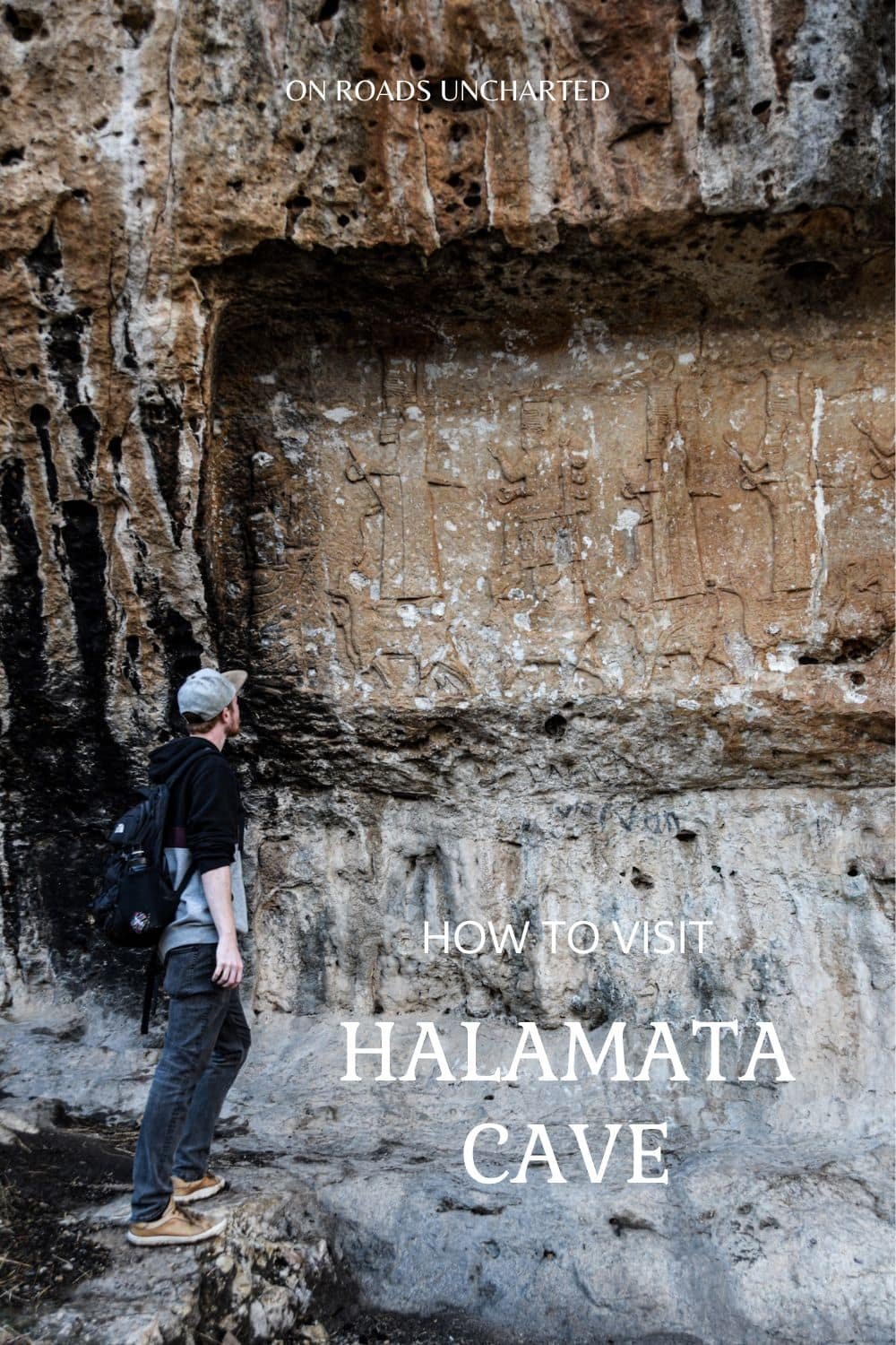
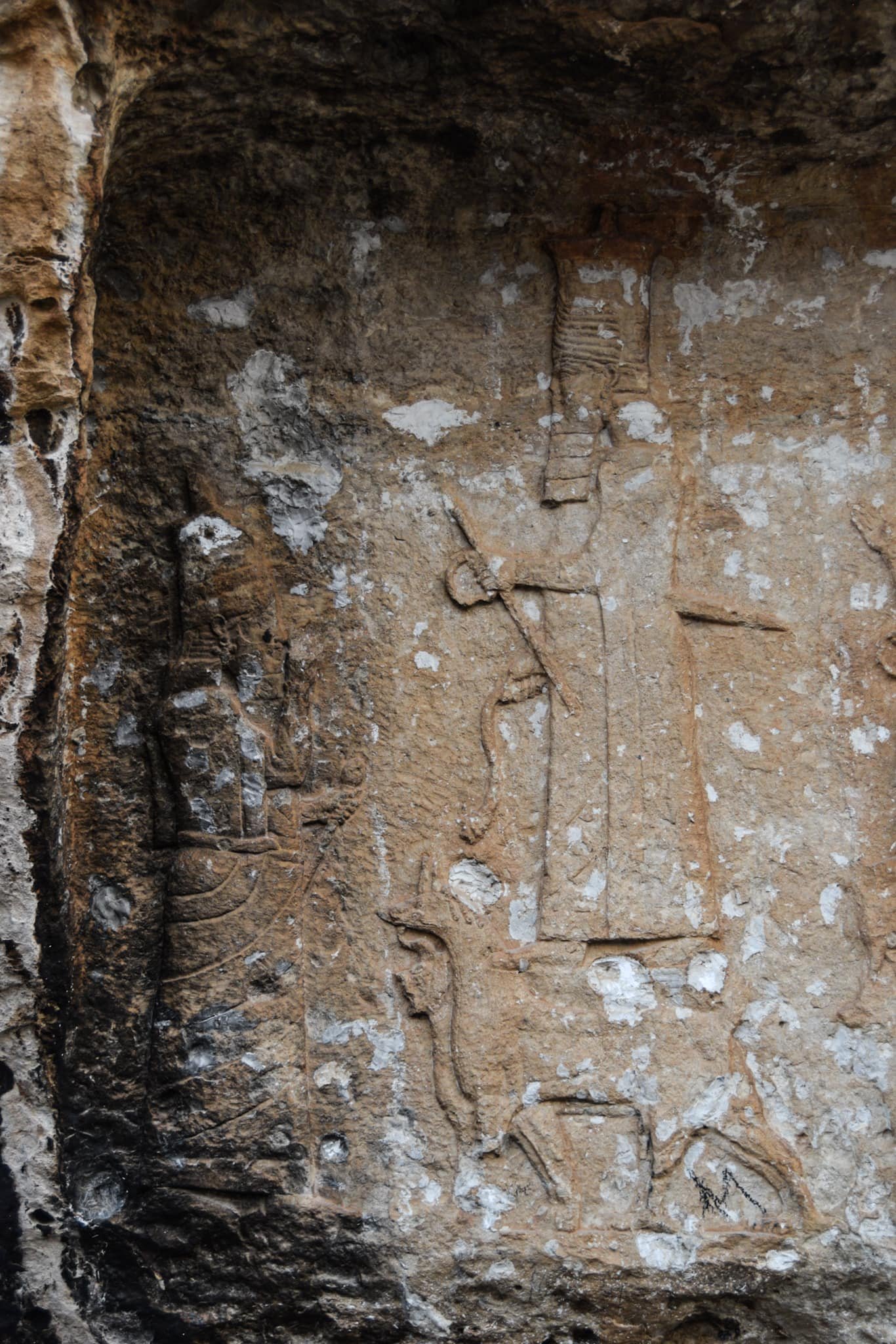
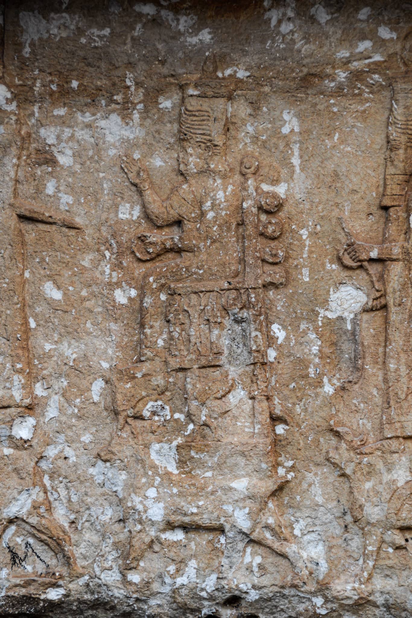
Chiselled into the bare rockface high above the busy streets of Dohuk, four impressive carvings from the Neo-Assyrian period have braved the elements for millennia. Although relatively small, they constitute an invaluable glimpse into the region’s ancient past and remain the city’s most intriguing archaeological site.
Little is known about these mesmerising bas-reliefs gracing the rocky slopes of Zawa Mountain.
Constructed at an uncertain point during the reign of Assyrian king Sennacherib (704-681 BCE), the carvings have been associated by historians with the construction of an extensive canal system, built to supply the empire’s capital Nineveh with fresh drinking water from the verdant mountains of Northern Iraq. As for the exact purpose of these ancient artworks one can only speculate (this article goes into more depth), however, their unique iconography distinguishes them immensely from other examples of Assyrian royal art.
Whereas the king is usually shown worshipping divine symbols, the Maltai reliefs present him in front of seven anthropomorphic figures/gods in human form from the Mesopotamian pantheon (five male and two female deities) mounted on animals and mythological creatures. The procession is then concluded by another image of the sovereign. This atypical depiction, elevating Sennacherib to a god-like status, therefore, appears to be a novelty of the late Neo-Assyrian period.
While some of the carvings are still in impeccable condition, unfortunately, others have suffered in recent times. In 2016, irreverent graffiti “artists” decorated Halamata Cave with a Kurdish flag (which has since been removed), and in 2018, the site was brutally vandalised when an entire piece was simply stolen from the bedrock.
Most of the ancient landmark remains relatively untouched, however, and although you won’t spend much time at the caves, they make for a great little excursion should you find yourself in Dohuk.

HOW TO FIND HALAMATA CAVE
BEFORE YOU START
Since you will approach the archaeological site from above and the reliefs won’t reveal themselves until the very last moment, finding Halamata Cave might prove to be a bit of a challenge if you don’t know what you are looking for. However, if you keep track of a few waypoints on the descent, reaching the cave is easier than expected.
Before I give you detailed directions though, I wanted to let you know that the pin “Halamata the Assyrian sculptures” on Google Maps does show the correct location. Some comments suggest it doesn’t, however I reckon they refer to the Kurdish pin which is indeed in the wrong spot. Maps.me depicts the right location, as well.
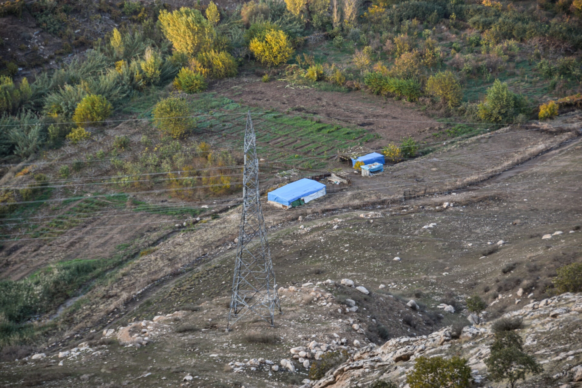
Finding the trail might be a bit confusing, however, if you are heading in the general direction of the caves (as pinned on Google Maps) you will find it eventually. There is also an electricity pylon next to two blue-roofed sheds at the bottom of the mountain to use as a reference point, as it aligns perfectly with the site (see picture below).
Also, before you depart on your little adventure be aware that after rainfall the ground becomes incredibly sticky (and slippery on the downhill sections), therefore I highly recommend bringing good footwear. There is also a short stretch where you will need to climb down a small ravine, nothing major but keep that in mind if you are uncomfortable with such endeavours.
REACHING ZAWA MOUNTAIN
The reliefs are situated on the slopes of Zawa Mountain overlooking the southern outskirts of Dohuk. Even though you could hike up Zawa Mountain, I really don’t think it is worth the hustle (the walk will be very unappealing, as well). Therefore, in order to reach the top, you will either have to take a taxi or ride the Zawa cable car.
While hopping on the cable car might be an exciting experience, I do not recommend it. Not only will it be way more expensive (10.000 IQD/person/one way) but you will arrive nearly 2,5 kilometres east of the caves. A taxi will only cost 7.000 IQD (December 2022) and will drop you right at the trailhead. Alternatively, you could also opt to hitchhike, which works exceptionally well in Kurdistan.
FINDING THE TRAIL
In order to find the trailhead, draw a straight line from the archaeological site (as pinned on Google Maps) down to the main road that runs along the crest of Zawa Mountain. As you drive/hike up the mountain from the westside, you will spot five red arrows painted on a metal post on the right side of the road and a small rundown shed surrounded by bulk rubbish on the left (see pictures below).
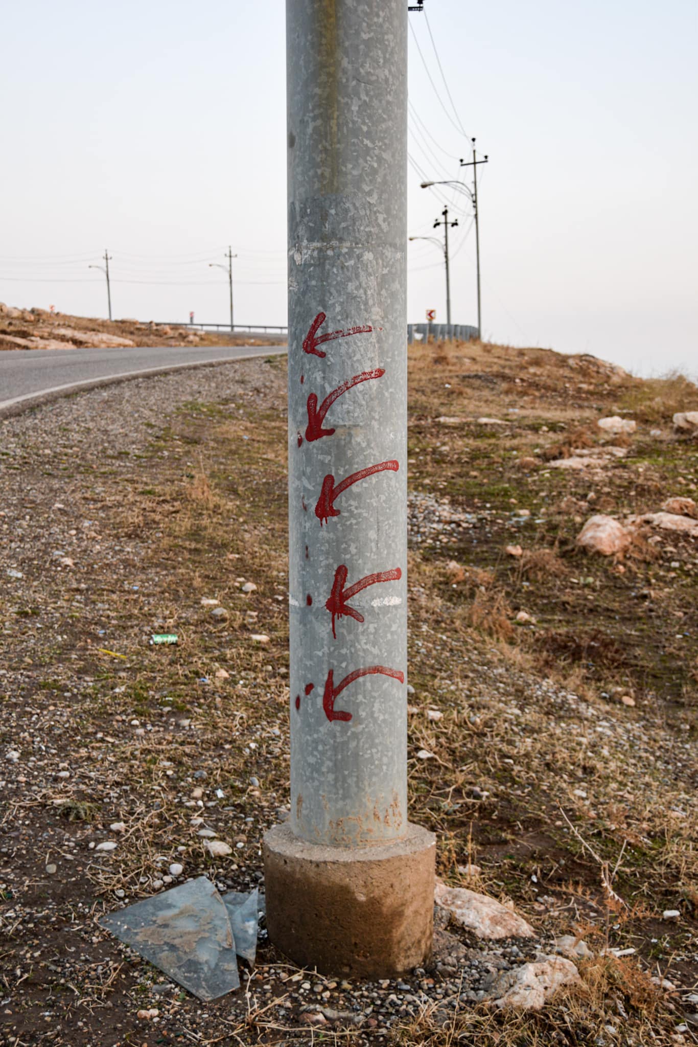


So far so good, however, this is where it gets a bit trickier. Even though there is a trail marked with red arrows, chances are you won’t see it at all in the beginning, as the path is extremely difficult to make out between the rocks scattered around (the marks are also severely weathered).
After leaving the road walk straight down the slope (with a tiny inkling to the right) until you either come across the trail or end up at a cliff. Should the latter be the case simply turn right and follow the edge until you find the path running in an eastward direction.
Shortly after you will spot a small ravine veering off to the left. Follow the path into the crevice and scramble down the rocky section.
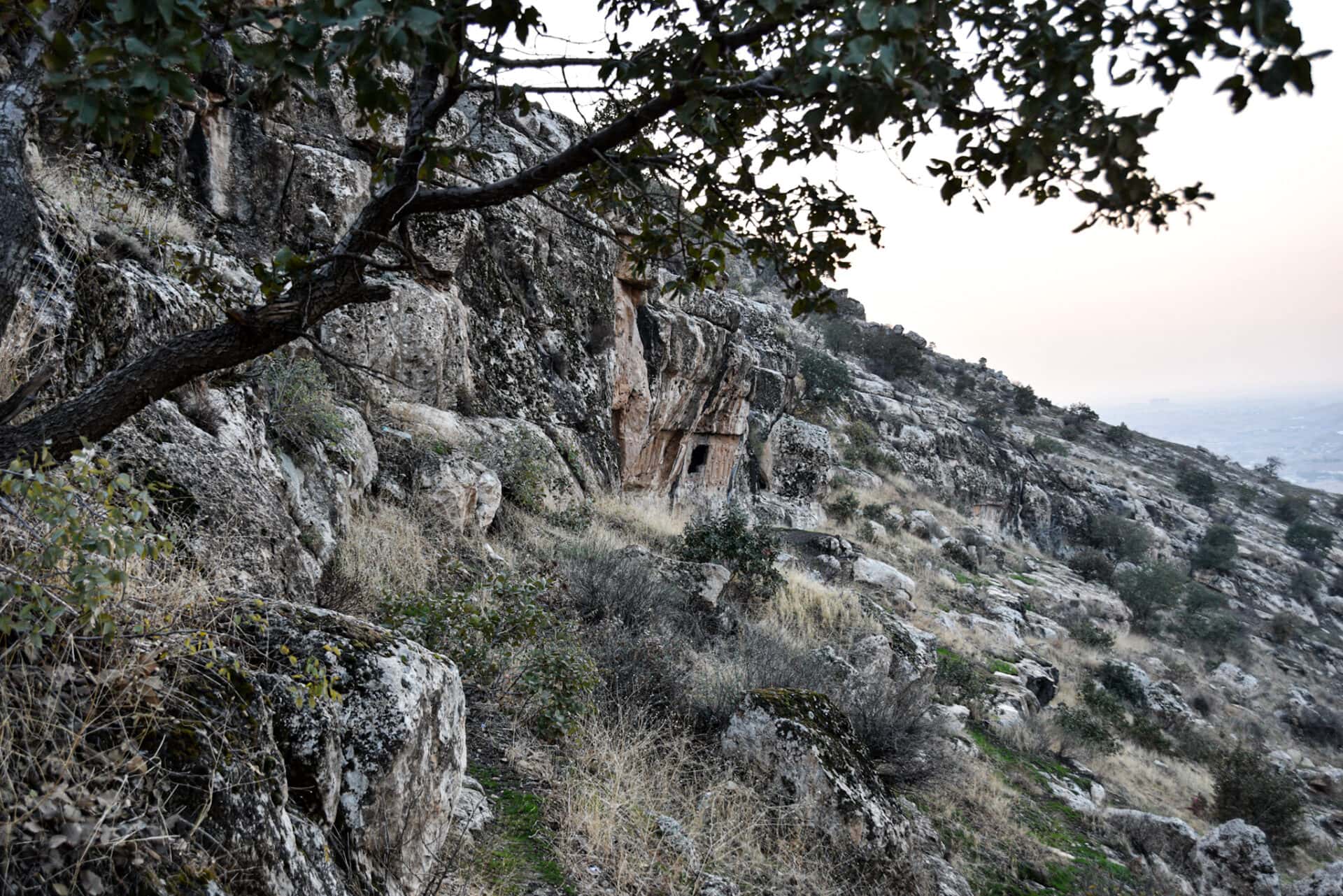
After this little exercise you will encounter another cliff in front of you. Halamata Cave will now be right below you. On your right you will register two paths, one running along the edge down the mountainside and the other one eastward. Chose the one descending and follow it for about two minutes. It will then branch off to the left. From there you should already be able to see the site.
Just a little bit further and you have successfully reached Halamata Cave.
WHERE TO NEXT?
For more content consider following me on Instagram.
Civilizations rise and fall. Here are more ancient wonders for you to explore on your next trip:
MOUNT NEMRUT | WHERE GODS REST
